EXISTENCE
Scroll to explore
Scorched Memory
An immersive AI-driven installation that investigates how landscapes record wildfire long after the flames disappear. Using the 2025 Los Angeles wildfires as its primary point of departure, the work proposes a new way of perceiving landscape as a living archive — one that stores rupture not only in images of destruction, but in material traces, ecological shifts, and delayed forms of regrowth.
The project centers on the slower aftermath of fire: scorched vegetation, altered topographies, damaged structures, fragmented habitats, atmospheric residue, and the uneven rhythms of ecological return.
57,529
Acres Burned
18,000+
Structures Destroyed
200,000
People Evacuated
1,594
Data Records
76
Years of Data (1950–2026)
35+
Dataset Files
The Arc of Landscape Memory
Each chapter addresses a distinct temporal register of the landscape's transformation — from the moment of rupture through the slow, uneven process of ecological return.
Chapter I
Existence
75 years of living landscape. Chaparral, coastal sage scrub, oak woodland — vegetation that took decades to mature. NDVI indices, rainfall patterns, mycorrhizal networks beneath the soil. The terrain before rupture.
Chapter II
Destruction
January 7, 2025. Santa Ana winds at 99 mph. PM2.5 at 484 µg/m³. 23,448 acres consumed in 48 hours. Burn severity, thermal intensity, structural loss rendered as spatial and chromatic data fields.
Chapter III
Rebirth
The uneven, nonlinear return of ecological life. Pyrophilous fungi fruiting from ash. Chamise resprouting from burned root crowns. NDVI climbing from 0.05 to 0.40. The landscape remembering how to live.
Existence I Existence II Destruction I Destruction II Rebirth I Rebirth II
Building a Living Archive
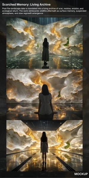
The installation is driven by a comprehensive dataset spanning 76 years of ecological, geological, demographic, and economic transformation across the Los Angeles Basin — from 1950 to the present day.
Layer 01
Vegetation & Fungi
NDVI time-series, chaparral coverage shifts, mycorrhizal network data, post-fire fungal succession patterns, invasive species colonization rates.
Layer 02
Geology & Hydrology
75+ seismic events, landslide records, coastal erosion rates, post-fire debris flow probability maps, soil burn severity indices.
Layer 03
Wildlife & Habitat
Mountain lion tracking data, California Condor recovery, steelhead trout displacement, 23 species displacement records, habitat loss acreage.
Layer 04
Human Landscape
Population demographics, economic stratification, displacement patterns, insurance system collapse, rebuilding trajectories across race and class.
Layer 05
Atmosphere
PM2.5 readings, NO₂ concentrations, benzene levels, TEMPO satellite air quality data, water contamination records from fire runoff.
Layer 06
Satellite Archive
100+ satellite images from NASA, USGS, ESA. AVIRIS-3 burn severity at 3.2m resolution. LiDAR before/after elevation models. ISS astronaut photography.
Ozgenur Bakan
Landscape Architect & Spatial Researcher
A landscape architect and spatial researcher working at the intersection of environmental memory, disaster ecology, and AI-driven visual practice. Her work investigates how landscapes register catastrophe — not only through physical destruction, but through deeper shifts in vegetation, hydrology, wildlife corridors, and collective spatial memory.
Currently based near Los Angeles — working in close proximity to the landscapes scarred by the 2025 wildfires — she uses AI as an interpretive medium: a way to let data hold memory, and to make the invisible grief of burned terrain legible.